

Visualizing Gibraltar as an Island: A 3D Reconstruction
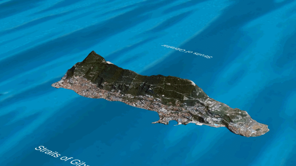
In this post, I’ll be sharing a video visualization of Gibraltar as an island in the Mediterranean — with the face of the Rock pointing west toward the Atlantic Ocean, exactly as many of us remember it. This is not a random animation. I had this visualization created using 3D terrain, with the Rock of […]
A Map Drawn From Memory: Gibraltar as an Island
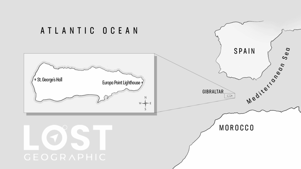
In this post, I’ll be sharing an image of a map I drew myself. This map is not based on modern atlases or current geography. It is drawn entirely from memory — my memory of the reality in which Gibraltar was an island. This is how Gibraltar used to exist on all maps: The maps […]
Reality Residue in Print: Six Books That Call Gibraltar an Island
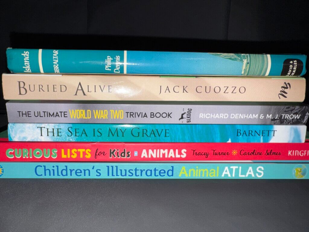
In this post, I’ll be sharing photographic evidence from six physical books I’ve purchased online through sites like Amazon and eBay — books that contain what I consider to be clear reality residue of Gibraltar being an island. For each book, I’ll be showing: If you’re interested, you can purchase these books on your own […]
Matthew McKinley Takes on the Gibraltar Mandela Effect

I recently came across a 50-minute YouTube video by Quantum of Conscience, also known as Matthew McKinley, focused entirely on the Gibraltar Mandela Effect. At the time of writing this, the video has accumulated roughly 11,000 views. I immediately recognized Matt’s channel from the early days of the Mandela Effect, back when the phenomenon was […]
Reddit Threads Remembering Gibraltar As An Island

For many people researching geographical Mandela Effects, one of the most powerful tools isn’t official maps or textbooks — it’s shared memory. Long before the Mandela Effect became a mainstream term, online forums like Reddit quietly collected thousands of firsthand recollections from people who noticed changes that didn’t match what they remembered. Among these recurring […]
California as an island: Evidence of Hidden Worlds, NOT a mapping mistake nor a myth
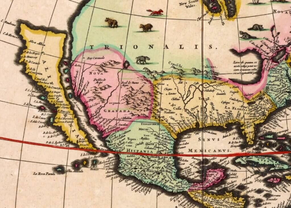
For approximately 250 years, spanning the 16th to the 19th century, maps worldwide consistently showed California as an island. This belief persisted for nearly three centuries, reflecting a global agreement about California being an isolated land surrounded by water. Many maps, numbering in the hundreds if not thousands, during this time illustrated California as distinct […]