In this post, I’m going to do my best to explain what I mean when I talk about hidden worlds — the many worlds that exist within our reality, on this same Earth we’re on, yet remain invisible to the naked eye.
I also want to explain why I believe these hidden worlds are real, and how geographical Mandela Effects serve as evidence of their existence.
A World Similar — and Different — at the Same Time
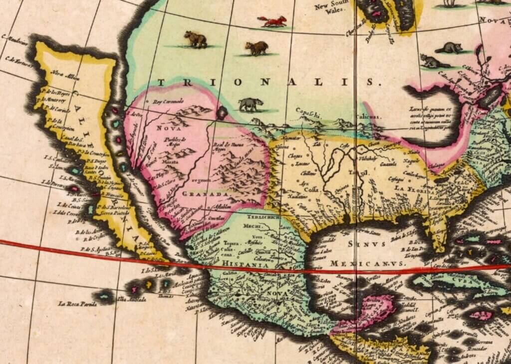
There are other worlds like this one where the world map exists very similarly, yet very differently at the same time.
Some of these worlds we’ve partially experienced through geographical Mandela Effects — changes people remember that no longer align with current maps. Others are worlds we’ve never directly experienced at all. They remain completely hidden, existing in another time and space.
I’ve used this analogy before, but it’s worth repeating:
Think of reality or the world map like a radio.
Each hidden world exists on a different frequency.
We’re tuned into one frequency, but fragments from other frequencies sometimes bleed through. These fragments are what I refer to as reality residue — small bits of information lingering in our world that don’t fully belong here.
If we learn how to recognize these fragments, we can begin to decode them.
Reading the World Map Differently
Let’s start with something simple.
Open a world map — preferably one that clearly shows border lines between countries and territories. Google Maps works perfectly for this.
Once you have it open, look for border lines that are perfectly straight:
- Vertical
- Horizontal
- Diagonal
- Solid or dashed
Now ask yourself a question:
Why would borders between nations — shaped by geography, war, culture, and history — be perfectly straight?
Straight lines don’t occur naturally in landscapes. They’re artificial markers.
Markers of something else.
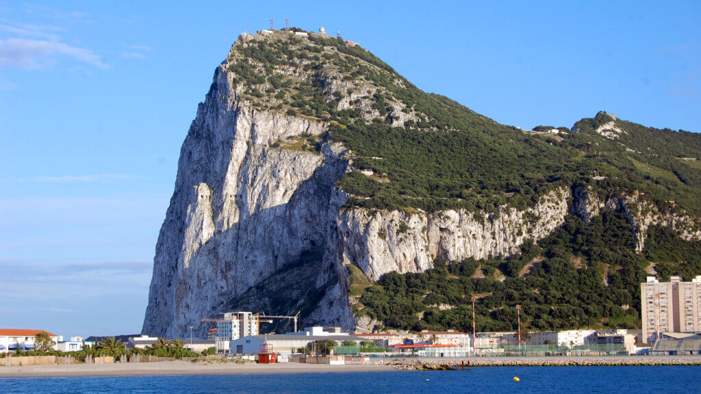
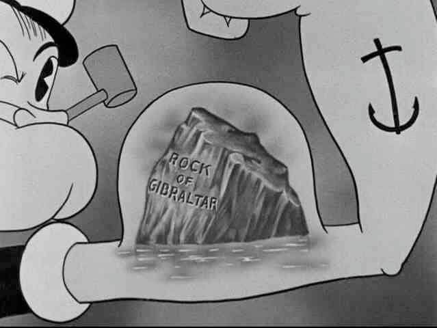
Gibraltar: A Border That Reveals Too Much
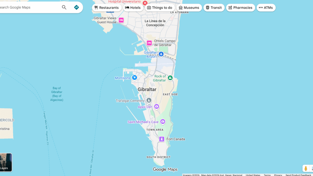
Now focus on the border line between Spain and Gibraltar, known as La Línea de la Concepción.
Gibraltar is physically attached to Spain, yet politically it is a British Overseas Territory. That alone is unusual.
But look closely at the border:
- It’s an undefined line
- It’s somewhat horizontally straight
Officially, this border exists because Gibraltar is British and not Spanish. But there’s a deeper reason.
This border is hinting at something we can’t see.
In another reality — one that some of us remember — Gibraltar is an island, completely separated from Spain.
That is why this small peninsula is not part of Spain.
That is why it is British.
That is why the border is undefined.
The border itself is quietly telling us something.
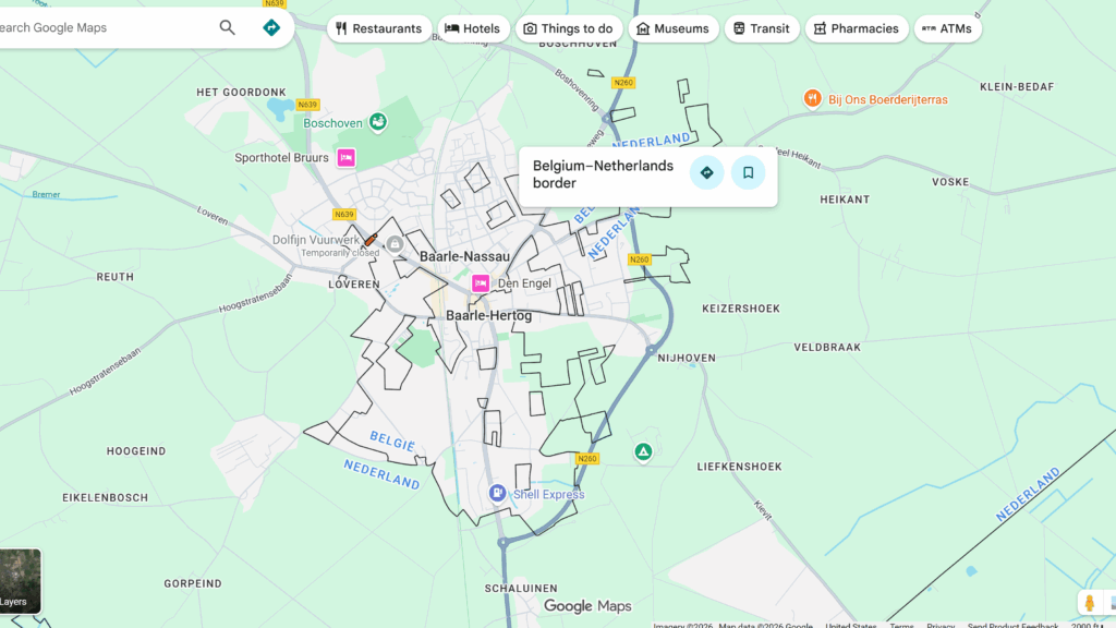
Enclaves: Countries Within Countries
Now zoom out and look again at the world map.
This time, look for enclaves — countries that exist entirely inside another country.
Ask yourself:
- Why do these places exist independently?
- Why weren’t they absorbed by the country they’re surrounded by?
Take San Marino as an example.
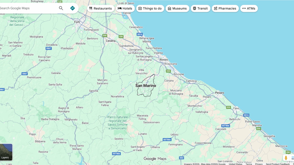
San Marino is a tiny country completely surrounded by Italy. It has been independent since 301 AD.
Let that sink in.
How has such a small country remained independent for over 1,700 years — while being fully surrounded by a much larger nation?
Once again, the borders are quietly hinting at something else.
Based on my research into San Marino — and the similarities I’ve found with Gibraltar — I believe San Marino exists as an island in another reality.
I’ve found residue referring to San Marino as an island, much like the residue associated with Gibraltar. The pattern is strikingly similar.
Undefined Borders and Disputed Lands
Now look for undefined or dashed borders elsewhere on the map — areas often labeled as disputed territories.
The standard explanation is political disagreement.
But I believe there may be something more happening.
What if these lands are disputed because they exist at the intersection of hidden worlds?
What if people on each side of the border are literally experiencing slightly different realities — seeing something the other side does not?
This could explain why certain borders are perpetually disputed, unresolved, and unstable.
Gibraltar itself is still considered disputed territory with Spain — yet remains British.
Why?
A Blended Map of Multiple Worlds
Once you begin to see this pattern, something becomes clear:
When we look at a world map, we are not looking at a single, unified world.
We are looking at a blend of hidden worlds.
Each piece of land separated by borders exists within its own time and space, overlapping just enough to coexist — but not enough to fully merge.
We can physically cross these borders, as I did when visiting Gibraltar. Life appears to be normal. People go about their daily routines crossing the border. Nothing feels unusual on the surface.
But the true nature of the border isn’t physical.
It’s hidden.
Learning to Decode Reality
The borders on the map aren’t just political lines.
They are clues.
They are markers of overlapping realities, quietly revealing where worlds meet, blend, or fail to fully align.
Once you begin to decode them, you start seeing the world differently.
In future posts, I’ll continue expanding on this theory and provide more examples to support it. My goal is to show that geographical Mandela Effects aren’t random errors — they are signals, pointing toward something much larger than we’ve been taught to see.
Hidden worlds aren’t elsewhere.
They’re already here.